


















0 reviews
Be the first to review this item!

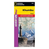
An index of places, passes, lakes and peaks, including Mt. Everest, will help you find both destinations and obstacles along on your adventure. Topographic information such as contour lines, elevations, mapped peaks and passes, water features, glaciers and forested areas will aid in your navigation. Other pinpointed features include with airports, campsites, lodging facilities, temples, monasteries, chortens, caves, waterfalls, hot springs and settlements. A multi-lingual legend (in English, German, French and Italian) will assist in your communication with international explorers.
The reverse side displays a map of Nepal in its entirety along with inset maps the Kathmandu region and of the Thamel neighborhood. These inset maps show roads, hotels, embassies and consulates, police stations, banks, shopping complexes, hospitals and places of worship. Included also is background information about visiting and trekking in Nepal.
 Attention CA Residents: Prop 65 Warning
WARNING:
This product can expose you to chemicals which are known to the State of California to cause cancer, birth defects, or other reproductive harm. For more information, go to www.p65warnings.ca.gov.