


0 reviews
Be the first to review this item!

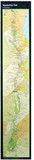
Thirteenth edition, 2009. Covers 296 miles from Damascus, Virginia, near the Tennessee line to the southern end of the Great Smoky Mountains National Park at Fontana Dam, North Carolina. Includes parts of the Cherokee and Pisgah national forests and the park. Includes four five-color topographic maps on two sheets, with elevation profiles (scale, 1:63,360), plus the five-color topographic map of the park (scale, 1:62,500) published by Trails Illustrated. 275 pages.
 Attention CA Residents: Prop 65 Warning
WARNING:
This product can expose you to chemicals which are known to the State of California to cause cancer, birth defects, or other reproductive harm. For more information, go to www.p65warnings.ca.gov.