skip to footer block
EQU National Geographic 603146 Old Forge Osegatchie Adirondack Pack No. 745 P7550223EQU-603146 https://cdnimages.opentip.com/full/EQU/EQU-603146.jpg National Geographic 603146 Old Forge Osegatchie Adirondack Pack No. 745 National Geographic\'s Trails Illustrated map of the Old Forge and Oswegatchie region of Adirondack Park is designed to meet the needs of outdoor enthusiasts by combining valuable information with unmatched detail of this beautiful park. Expertly researched and created in partnership with local land management agencies including the Adirondack Mountain Club, this map features key points of interest including Fulton Chain Lakes; William C. Whitney, Five Ponds, Pigeon Lake and Ha-De-Ron-Dah wilderness areas; Stillwater Reservoir; Independence River and Black River wild forests; and Tupper and Cranberry lakes.Miles of trails including the Cranberry Lake 50 Trail are clearly marked with mileage between intersections to help you plan your excursions. Whether you enjoy hiking, horseback riding, biking, snowshoeing, cross country skiing, or snowmobiling, the extensive trail chart will help you choose a trail that\'s right for your activity level. Recreation features are clearly marked, including ski areas, campgrounds, fishing and canoe access, swimming areas, boat launches, and more. A variety of helpful safety information and outdoor recreation guidelines are included as well. The map base includes contour lines and elevations for summits, passes and major lakes. 7550223 749717017450 1.0400lbs 0.00 0.00 0.00
National Geographic
10.4000 2025-04-26 Out of Stock

National Geographic 603146 Old Forge Osegatchie Adirondack Pack No. 745

Shop more from EQU

UPC: 749717017450
SKU: EQU-603146
Price: $10.40
Quantity:
Out of Stock
*  Click "Add to Shopping List" to save the item for later purchase. You can receive a notice email when it is back in stock.
Share & Earn 10% Cash Back Best Price in Bulk

Product Description

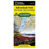
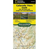
National Geographic's Trails Illustrated map of the Old Forge and Oswegatchie region of Adirondack Park is designed to meet the needs of outdoor enthusiasts by combining valuable information with unmatched detail of this beautiful park. Expertly researched and created in partnership with local land management agencies including the Adirondack Mountain Club, this map features key points of interest including Fulton Chain Lakes; William C. Whitney, Five Ponds, Pigeon Lake and Ha-De-Ron-Dah wilderness areas; Stillwater Reservoir; Independence River and Black River wild forests; and Tupper and Cranberry lakes.

Miles of trails including the Cranberry Lake 50 Trail are clearly marked with mileage between intersections to help you plan your excursions. Whether you enjoy hiking, horseback riding, biking, snowshoeing, cross country skiing, or snowmobiling, the extensive trail chart will help you choose a trail that's right for your activity level. Recreation features are clearly marked, including ski areas, campgrounds, fishing and canoe access, swimming areas, boat launches, and more. A variety of helpful safety information and outdoor recreation guidelines are included as well. The map base includes contour lines and elevations for summits, passes and major lakes.

warning tips WARNING: This product can expose you to chemicals which are known to the State of California to cause cancer, birth defects, or other reproductive harm. For more information, go to www.p65warnings.ca.gov.
Need more information?
Our staff are available to answer any questions you may have about this item


Customer Reviews
0 reviews
Be the first to review this item!