


4 out of 5

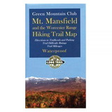
National Geographic TI00000749 Mount Mansfield, Stowe #749
* Click "Add to Cart" to calculate shipping and delivery time.
Product Description
Enjoy the year-round recreational opportunities in northern Vermont with National Geographic's Trails Illustrated map of Mount Mansfield and Stowe. Expertly researched and created in cooperation with the Vermont Agency of Natural Resources and others, the map delivers unparalleled detail of the area from Sandbar State Park and Malletts Bay in the northwest to the city of Barre in the southeast. Covered are tens of local and town parks; lakes, reservoirs and other waterways; state parks, forests and wildlife management areas, including the popular recreation areas Green Mountains, Camels Hump State Park and Mount Mansfield State Forest. Also covered are the cities of Burlington, Essex Junction, Montpelier, Barre and Stowe as well as a complete road network of the area.
The Cross Vermont, Catamount and Long Trails are all highlighted and shown with their parking areas, cabins and shelters. The Lake Champlain, Green Mountain and Mad River Scenic Byways marked as well. Other recreation points of interest noted are areas for hiking, alpine skiing, swimming, fishing, camping, canoe carry downs and picnics as well as waterfalls, covered bridges, lookout towers and interpretive trails. To aid in your navigation, the map includes contour lines, elevations, labeled peaks and summits, water features and clear color-coded boundaries between different land management agencies.
Other features found on this map include: Burlington, Colchester, Dog River, Green Mountains, Hogback Mountains, Lamoille River, Mad River, Milton, Mount Mansfield, Northfield Mountains, South Burlington, Sterling Range, Winooski River, Worcester Mountains.
 Attention CA Residents: Prop 65 Warning
WARNING:
This product can expose you to chemicals which are known to the State of California to cause cancer, birth defects, or other reproductive harm. For more information, go to www.p65warnings.ca.gov.
Need more information?
Our staff are available to answer any questions you may have about this item
Our staff are available to answer any questions you may have about this item
Customer Reviews
By Lonebadger
Date: January 16, 2018
not as well detailed with mileage as say the New York series.
Rating:  [3 of 5 Stars!]
[3 of 5 Stars!]
By TJW
Date: May 12, 2017
National Geographic maps are full of detail, accurate and can take a beating in the field. They are the first map I look for when searching for a map for my adventures.
Rating:  [5 of 5 Stars!]
[5 of 5 Stars!]
Items 1 - 2 of 2 reviews
1