


5 out of 5

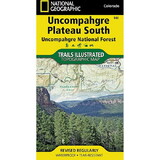
National Geographic 603381 Uncompahgre Plateau North No.147
* Click "Add to Cart" to calculate shipping and delivery time.
Product Description
Manufacturer Part Number: TI00000147
National Geographic's Trails Illustrated map of Uncompahgre Plateau North is created for outdoor enthusiasts exploring the year-round recreational opportunities in this unique area in southwestern Colorado. Expertly researched and created in cooperation with the U.S. Forest Service, Bureau of Land Management and others, the map provides unparalleled detail of northern Uncompahgre National Forest, Dominguez Escalante National Conservation Area, Dominguez Canyons Wilderness, Tabeguache and Roubideau Areas, Grand Mesa National Forest, Gunnison River, Unaweep-Tabeguache Scenic and Historic Byway and Tabeguache Trail.
Use the mapped trails, OHV routes and Forest Service roads to get off the beaten path and back on again while exploring the area's mesa and canyons. Trails are labeled according to their designated usage, whether exploring on foot, skis, horseback, mountain bike, motorcycle or ATV, including rock crawling trails. Seasonal roads and trails are labeled with their accessible dates. To aid in your navigation of the area, the map displays contour lines, elevations, labeled peaks and summits, water features, selected waypoints and clear color-coded boundaries between different land management agencies. Recreation activities pinpointed include areas for camping, fishing, swimming, water skiing and wildlife viewing.
Every Trails Illustrated map is printed on "Backcountry Tough" waterproof, tear-resistant paper. A full UTM grid is printed on the map to aid with GPS navigation.
Other features found on this map include: Grand Mesa National Forest, Uncompahgre National Forest.
 Attention CA Residents: Prop 65 Warning
WARNING:
This product can expose you to chemicals which are known to the State of California to cause cancer, birth defects, or other reproductive harm. For more information, go to www.p65warnings.ca.gov.
Need more information?
Our staff are available to answer any questions you may have about this item
Our staff are available to answer any questions you may have about this item
Customer Reviews
By Ben H.
Date: March 28, 2018
Durable; sufficient detail
Rating:  [5 of 5 Stars!]
[5 of 5 Stars!]
By Kathy Schlauger
Date: September 04, 2017
Small trails are clearly marked. I also downloaded the electronic version and used it with Avenza Map. We would have definitely been lost without it.
Rating: [5 of 5 Stars!]
[5 of 5 Stars!]
By shawn i
Date: August 15, 2017
quality
Rating: [5 of 5 Stars!]
[5 of 5 Stars!]
Items 1 - 3 of 3 reviews
1