skip to footer block
EQU National Geographic 603064 Salida St. Elmo &Amp; Mt. Shavano No.130 P7550175EQU-603064 https://cdnimages.opentip.com/full/EQU/EQU-603064.jpg National Geographic 603064 Salida St. Elmo &Amp; Mt. Shavano No.130 National Geographic\'s Trail Illustrated map of Salida, St. Elmo and Mount Shavano offers unparalleled detail for outdoor enthusiasts exploring this area in the heart of the San Isabel National Forest. Expertly researched and created in partnership with the U.S. Forest Service, the Bureau of Land Management and others, this map will guide you along the trails, up and down the peaks and across the rivers and lakes as you enjoy your adventure or recreation activity. The map features many points of interest, including North Fork Resevoir, Tabeguache Peak, Mount Princeton and the Collegiate Peaks Byway along with its many recreation areas.The map\'s clearly marked trails and trailheads can guide you off the beaten path and back again. Parts of the Continental Divide Trail and Colorado Trail that pass through the area are highlighted on the map as well as mountain bike routes. The map base includes contour lines and elevations for summits, passes, lakes and rivers. Some of the many recreation features noted include ski and snowmobile areas, shooting ranges, river access points and fishing areas, campgrounds and ranger stations.Every Trails Illustrated map is printed on \"Backcountry Tough\" waterproof, tear-resistant paper. A full UTM grid is printed on the map to aid with GPS navigation.Other features found on this map include: Gunnison National Forest, Mount Antero, Mount Princeton, Mount Shavano, San Isabel National Forest, Tabeguache Peak. 7550175 749717011304 1.0400lbs 0.00 0.00 0.00
National Geographic
10.4000 2025-04-19 Only 2 left In Stock

National Geographic 603064 Salida St. Elmo &Amp; Mt. Shavano No.130

See other products from EQU

UPC: 749717011304
SKU: EQU-603064
Price: $10.40
Quantity:
Only 2 left In Stock
*  Click "Add to Cart" to calculate shipping and delivery time.
Share & Earn 10% Cash Back Best Price in Bulk

Product Description

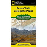
National Geographic's Trail Illustrated map of Salida, St. Elmo and Mount Shavano offers unparalleled detail for outdoor enthusiasts exploring this area in the heart of the San Isabel National Forest. Expertly researched and created in partnership with the U.S. Forest Service, the Bureau of Land Management and others, this map will guide you along the trails, up and down the peaks and across the rivers and lakes as you enjoy your adventure or recreation activity. The map features many points of interest, including North Fork Resevoir, Tabeguache Peak, Mount Princeton and the Collegiate Peaks Byway along with its many recreation areas.

The map's clearly marked trails and trailheads can guide you off the beaten path and back again. Parts of the Continental Divide Trail and Colorado Trail that pass through the area are highlighted on the map as well as mountain bike routes. The map base includes contour lines and elevations for summits, passes, lakes and rivers. Some of the many recreation features noted include ski and snowmobile areas, shooting ranges, river access points and fishing areas, campgrounds and ranger stations.

Every Trails Illustrated map is printed on "Backcountry Tough" waterproof, tear-resistant paper. A full UTM grid is printed on the map to aid with GPS navigation.

Other features found on this map include: Gunnison National Forest, Mount Antero, Mount Princeton, Mount Shavano, San Isabel National Forest, Tabeguache Peak.

warning tips WARNING: This product can expose you to chemicals which are known to the State of California to cause cancer, birth defects, or other reproductive harm. For more information, go to www.p65warnings.ca.gov.
Need more information?
Our staff are available to answer any questions you may have about this item


Customer Reviews
0 reviews
Be the first to review this item!